07:20 wake up and put on dry socks and dry boots.
Second breakfast of fallen birches – cantaloupe from Walmart cut by machete.
08:55 depart of an “excursion” number 2. I did not even take paper map with me – there is everything on iPhone GPS topo maps.
Today’s trip is much more interesting because every step is a discovery.
 |
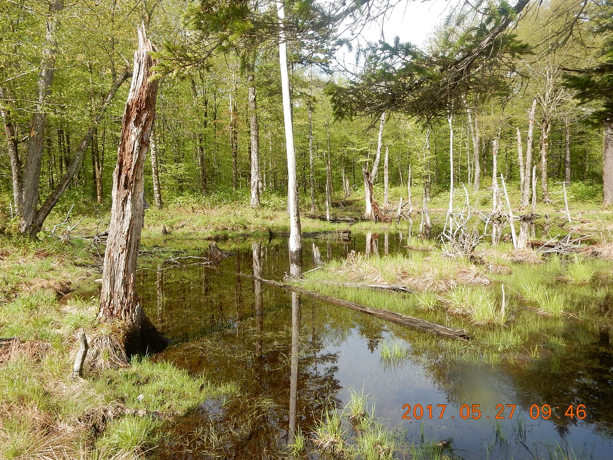 |
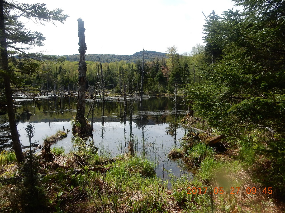
| 09:45 Get lost in beaver ponds. No wonder my feet are wet. Mt. Crescent (most likely) is visible on the background. | 09:46 Somewhere here used to be a path or even a road |
 |
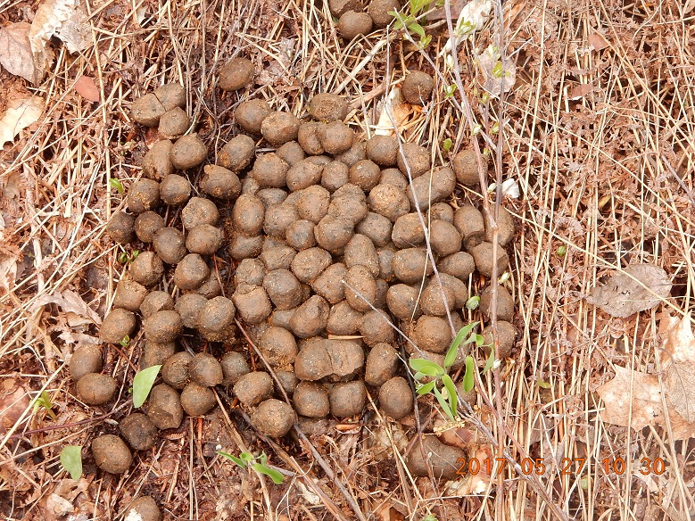 |
| 10:30 Something like a former road visible. Take a little break. Instead of going straight, I took another deviation sideways and across the river. Two huge tires dumped here many years ago, most likely when the road was still passable? When was it? 1969? | 10:30 Forest is fertile and vigorous with large live forms like these fresh moose droppings |
 |
 |
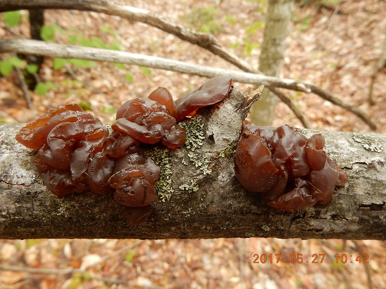
| 10:42 this grows here on the trees. Looks like dried figs, but this plan is alive! | 10:50 Upside down Christmas tree. Final push to get through dense forest and even some elevation |
Hunters Pass (2487′ = 758m) itself is not marked by anything. It is just a large swampy tangled area with no path or even a hint of the path. But you know that elevation stopped and you about to enter a new valley.
 |
 |
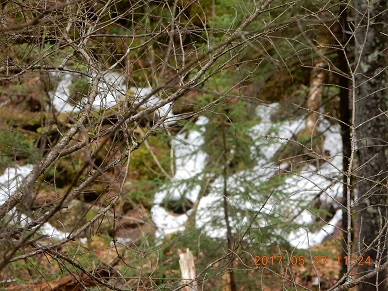
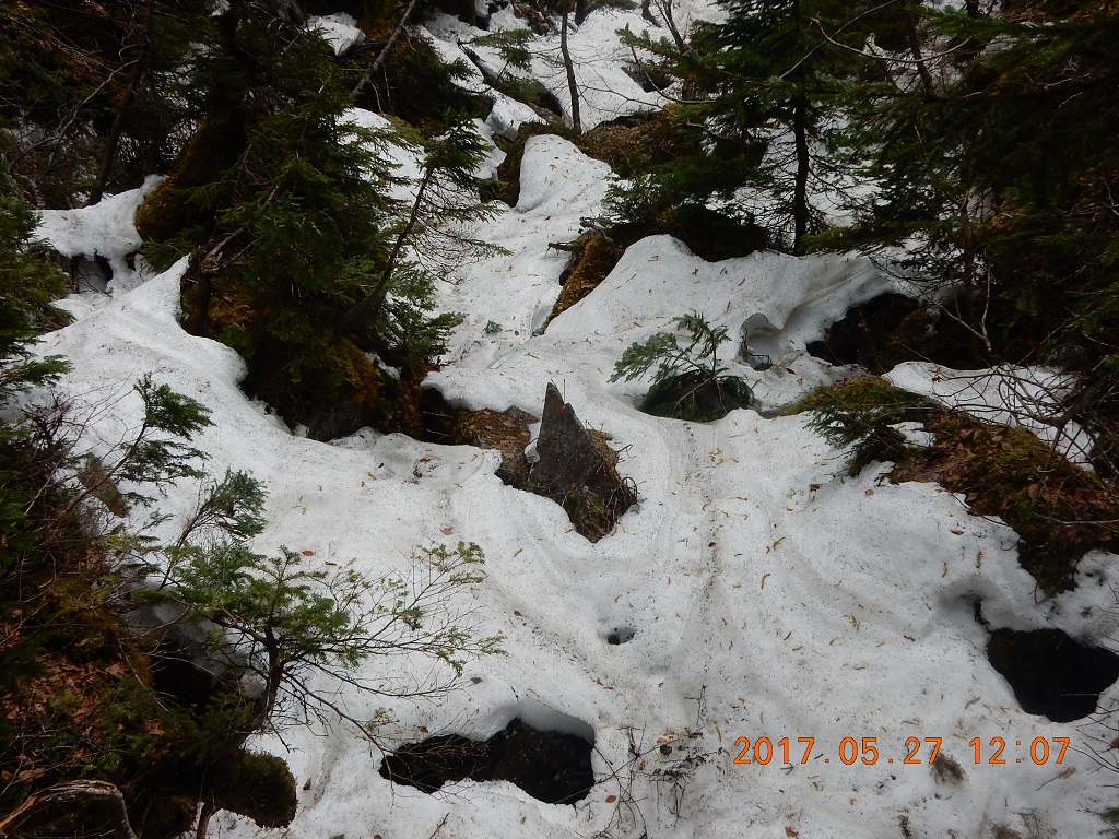
| 11:24 reach the Ice Gulch and snow, but where is the trail? It is strange, I do not see any signs of people here. | 11:38 break inside the gulch – 6 mandarins and one green apple. There is no clear path anywhere. Too narrow. Not a person insight. This is a very remote corner of “maintained” trail system. I called this trail “visibly invisible”. |
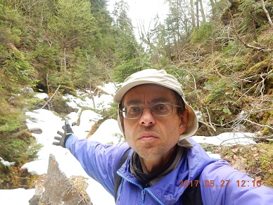
12:09 finally I see “markings in the wall” – faint orange paint marks first on stones and later (higher) on tree trunks.
 |
 |
| 12:07 on the snow. Snow is deep and dangerous. You can’t see where you step. Snow can give way and your foot could fall into boulders and shrub. | This is a very deep gorge with a very steep descend to the bottom. Sun rarely visits this nook of the woods. But there is a cell signal. Tell Lira I am OK and well. |
Bugs no longer bother warm blooded creates here and forest is mostly coniferous (evergreen).
 |
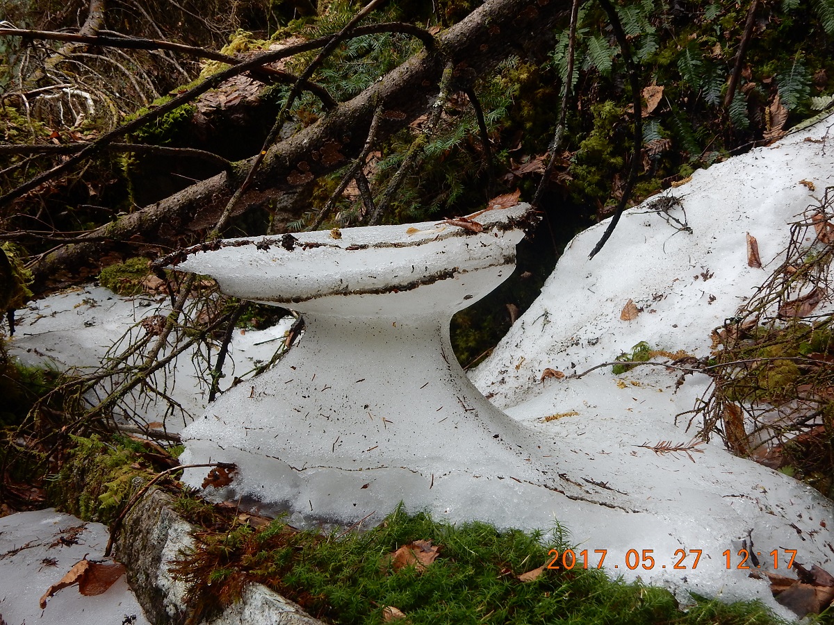 |
| 12:12 I can see an orange trail blaze, but I still can’t see the trail – Amazing! | 12:17 You saw similar structures in a desert shaped by years of wind corrosion. This snowy work of art is shaped entirely by micro-climate |
 |
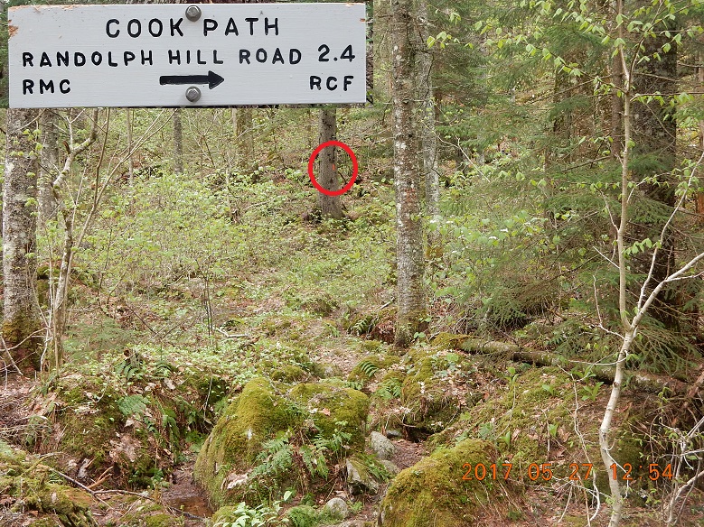 |
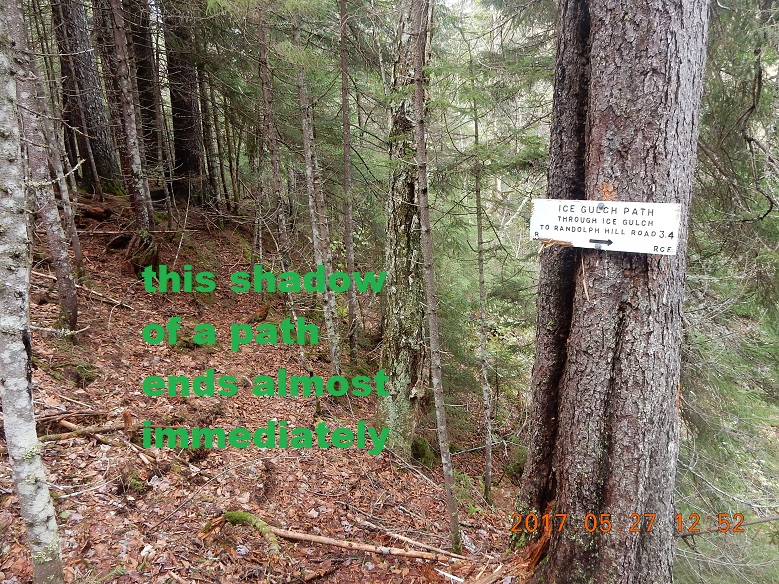
| 12:49 locate signs for Ice Gulch and Cook Path. Can I just follow the abandon trail down? No. It ends immediately at the cross-section. | Signs are fresh and clear, but trail is almost non existent. That is how civilizations scale back on their grip |
|
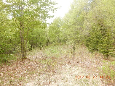 |
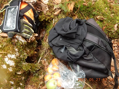
| There is no clear way towards Hunter’s Path. It is just a tangled mess of puddles, fallen trees and little dry islands of ground. | 14:21 Moment on the sun – a longer break using a rare sunny moment. Try to dry up the socks and boots – all wet. Cut and trim nail with always packed scissors. Mandarin’s crusts are removed from the cap and applied to skin for bug protection. |
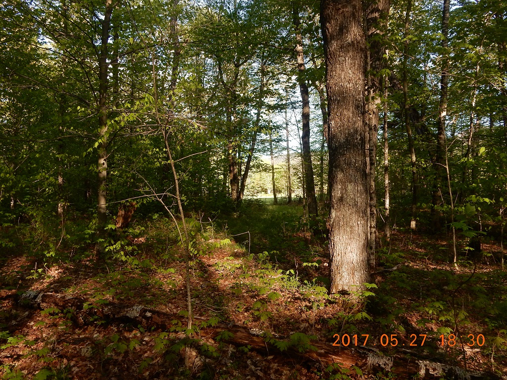
Instead of checking constantly with GPS and correcting my steps, I decided simply to follow the spring down, and that tactic worked. Pretty soon some kind of ghost of former road, or former tire tracks appeared, and I saw that I am on the proper way.
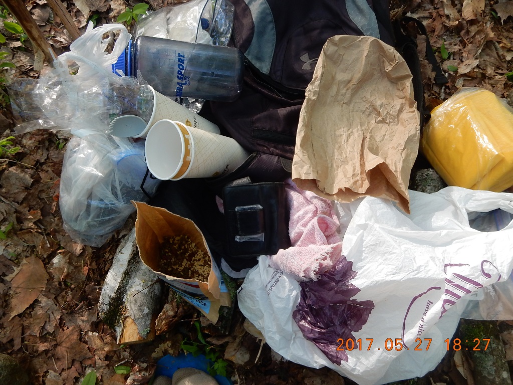
 15:00 exactly at 3PM I’ve reached crossroad between FR179 and ATV trail. Despite swarms of bugs – desire to take a deep into the cold water of a stream. Perfect spot – one of the bridges on ATV trail. It provides surface to place all your discarded things.
Black flies just loose you from their heat radar after you emerge from the cold water. Only a few good minutes later they start to detect warm body and attack again.
I Sawyer squeezed and refilled my water supplies, eat a small trail mix and completely refreshed returned to the camp.
16:04 I changed my boots from wet to a slightly dryer ones and departed the camp to build the bridge across the swollen river, that I need to cross every time I go to the car. On the way to the river I picked a long straight trunk that I picked already yesterday and placed along the trail, when I couldn’t cross the river and when I was thinking of alternatives way to cross the river after heavy rain. This turned out to be a very lucky turn of events. I did a small task yesterday and get a pay off today. The length of this very long “stick” was perfect to reach from one bank to the other. I would use this as a measuring stick to cut the serious tree trunks out of “fallen heroes” undercut by raging river. Not 50 yards away the whole embankment eroded and trees have fallen into the river like solders. Then got stuck in different poses waiting for a proper burial. To get these trees was an interesting and even dangerous undertaking. Some trees stuck upside down under a steep, freshly washed and crumbling wall of dirt and sand. Others, hoovering just over the middle of stream, making access to them very tricky. Despite all challenges and dangers, I cut and trimmed 4 tree trunks and brought them over close the river. Actual laying of the trunks across the river will a task for tomorrow – today I need to rush back to the camp to cook and relax.
17:29 Take pictures of the logs ready become a bridge tomorrow.
 |
 |
| Tomorrow morning it will be a bridge here! | Old bridge was too . . . complex to navigate |
~17:45 Second swim of the day. It is only about 19°C (66°F) now. When I emerged from water – what the strange thing? There is only one boot! Where is the other boot? Calm down. Calm down, I have another pair in the camp. But the boot only could have jumped into the stream. Let’s try to find it? Maybe it is still somewhere near. Not a 3 yards away, it was floating upside down in a quite area of the river.
My new cooking sequence was to boils enough water for both the meal and my tea. That way, none of the stove heat is wasted, and when I finished, I can simply blow the flame away, and pour the remaining alcohol back into the bottle. Maximum that I attempted to boil in one time was a little over 35 oz. of water. If you pour enough alcohol into stove center section, it will prime within 2 minutes with no intervention from you. I used stones to prevent pot to be upset from relatively narrow stove, and I used wind screen that I made from aluminum foil back at home. Everything worked great. I would spread (unfold) the screen around the pot and fasten the excess length with a paper clip. Very convenient. I learned this trick from YouTube video.
 |
 |
| I brought all relevant stuff from the tent outside right by the “cooking” tree. That way I could do everything outside, eat meal, change clothes, drink my tea. This is better outside today – more spacious and brighter. I even remembered to finished last 3 boiled potatoes that I brought from home. | 18:30 Ready to cook my third meal – Indian fair today. Not very good, but easy to prepare and consume. I tried to use last sunlight to dry everything. Here in the woods sun just getting through the leaves, but out there in the meadow sun is shining brightly. |
20:17 – 21:44 = 1H 27 min – regular evening entry in the log. Today is quiet – no rain or wind, and I can hear frogs singing songs in nearby pond. I killed about 20 little lazy black flies in one corner of the tent and pile the corpses into pee-bag. This is one other interesting shortcut or invention – use a sturdy package from the meal as a night vase. That way I do not even need to get out of the tent. Just pour the content of the pouch outside.
Navigate through the List
- NH Trip May 2017 - Preparations for the trip to Bog Dam Road (2017/05/22)
- Thursday, May 25 - Drive, Search, Camp and Rain - Perfect! (2017/05/22)
- Friday, May 26 - Remarkably Unremarkable Bunnell Notch Tr. to Mt. Cabot (2017/05/23)
- Saturday, May 27 - Visibly Invisible Trail (Hunters Pass) to Ice Gulch (2017/05/27)
- Sunday, May 28 - Relax to Unknown Pond (2017/06/07)
- Monday, May 29 - Mud, jaws, bridge and rain (2017/06/07)
- Tuesday, May 30 - We are so distracted by day job from our trail lives (2017/06/08)
- May 2017 Bog Dam Road trip - Lessons learned (2017/06/11)
Be the first to comment