Plan
On TUE, June 20 I ordered the AT topo map from Carlo Mountain to Pleasure Pond in Maine. This is a less traveled portion of Appalachian Trail (AT). From that point, the balance tipped toward going to AT instead of Bog Dam Road (BDR) for my July mini-vacation. Map expected to arrive June 26-30. This is very close to my departure date on FRI, June 30.
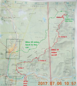
Preparations to my July 2017 trip to rarely visited section of AT between Gorham, NH and Grafton Notch State Park in Maine (route 26). This is a 31 miles section that is perfect for 3-4 nights trip. I will return on the bike back to the car. That could take over 3 hours or 35 miles on a private road. 16.5 miles lays in NH and 14.6 miles are in ME.
Day 1 – Car from Boston, hide bike in Newry, ME, return, hike 6.6 miles
Night 1 – FRI, Jun 30 to SAT, Jul 1 Page Pond (NH)
Day 2 – hike from Page pond to Gentain Pond Shelter – 5.2 miles
Night 2 – SAT, Jul 1 to SUN, Jul 2 Gentain Pond (NH)
Day 3 – hike from Gentain Pond to NH/ME border – 5.2 miles – cross into ME and hike to Full Goose Shelter – 4.4 miles+ Total = 9 miles
Night 3 – SUN, Jul 2 to MON, Jul 3 Carlo Col Shelter (ME)
Day 4 – 9 miles: 4.4 to Full Goose Shelter + 5.1 to Speck Pond 9.5
Night 4 – MON, Jul 3 to TUE, Jul 4 Old Speck Pond (ME) (fee $6)
Day 5 – 4.6 miles to route 26 and 15 miles on bike 4.6
Night 5 – TUE, Jul 5 to WED, Jul 5 off private Success Pond Road
Day 6 – bike 20 mi to car, lunch at Horseheathers, back to Boston
Total hiking miles calculated: 11.8 + 5.2 + 9.5 + 4.6= 31.1
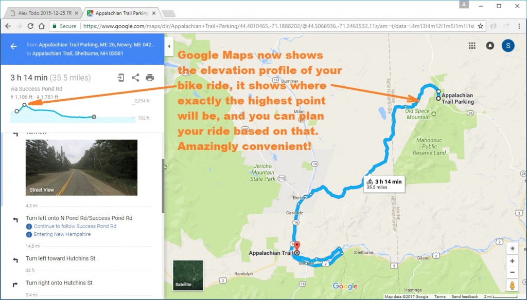
As for the planned return bike trip back to the car, I have a certain level of confidence that road is open and available for a bike. Google now shows not only the best bike route, but also an elevation profile that is incredibly important for planning your trip.
Specifics of this Trip
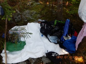
This trip might be a very different one. For the first time, I am planning a multi-day through hike with a complete set of modern cooking and sleeping tools. To camp, I would be able to stop anywhere. This time I do not have to shoot for shelters or tent sides. I have a hammock. I will not depend of dry firewood (alcohol stove) or water (Sawyer water filter).
Weather Forecasts
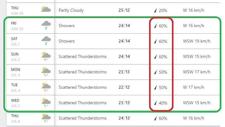
On WED, June 21 I could now see all my 6 days ATs on Weather.com. The weather for Berlin, NH looked half and half: 30 to 60% chance of rain every of 6 days and temperature 23-25°C during the day and 12-13°C at night. I do not see a single sunny or partially sunny day, but again, it could be a good thing – no need for sun protection.
Here is how forecast looked on June 22:
What was new this time?
– Small notebook instead of bulky regular Diary. The only drawback – it is ruled like a normal American notebook, it doesn’t have squares, like I like.
– American Eagle hiking shorts – very light and durable, and they are exactly my size (Marshals)
– Heavy Merino Wool Expedition Socks from REI ($10)
Abbreviations and Terminology
AT – Appalachian Trail
BDR – Bog Dam Road
ME – state of Maine
NH – state of New Hampshire
Puncheon – connected native logs to elevate the trail tread above wet areas that are not feasible to drain
Key Words
AT NH ME Gorham Shelburne Mahoosuc Range Grafton Notch State Park Newry Appalachian Trail
Navigate through the List
- Preparations for July 2017 trip to Appalachian Trail (AT) (2017/06/29)
- 2017/06/30 Friday - Who covers license plate with a Panama Hat? (2017/06/30)
- 2017/07/01 Saturday - Gift of shelter at the end (2017/07/01)
- 2017/07/02 Sunday - One of them now (2017/07/02)
- 2017/07/03 Monday - Endless Mahoosuc day with 7 miles (2017/07/03)
- 2017-07-04 Tuesday - From hike to bike, to car, to home (2017/07/04)


Be the first to comment