 |
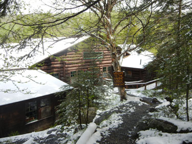 |
| 09:53 – All trails are starting from the main road | 09:54 – Dartmouth Ravine Lodge – the place of fun the place of knowledge |
After breakfast at cash only place in North Woodstock (where route 3 crosses with 112) I drove to Ravine Lodge on route 118, and started my way to the top at 10:35. This Memorial day weekend the weather was rainy and cold. But here, at 777 m elevation the rain turned into snow, and it was a very festive white on green, but snow here was just a pretty ornament.
 |
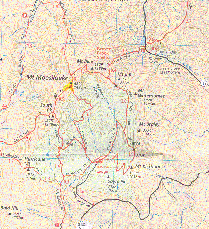 |
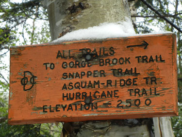
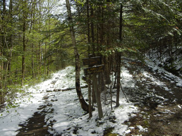
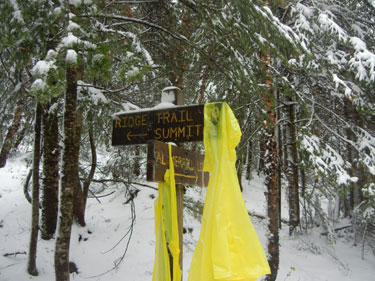
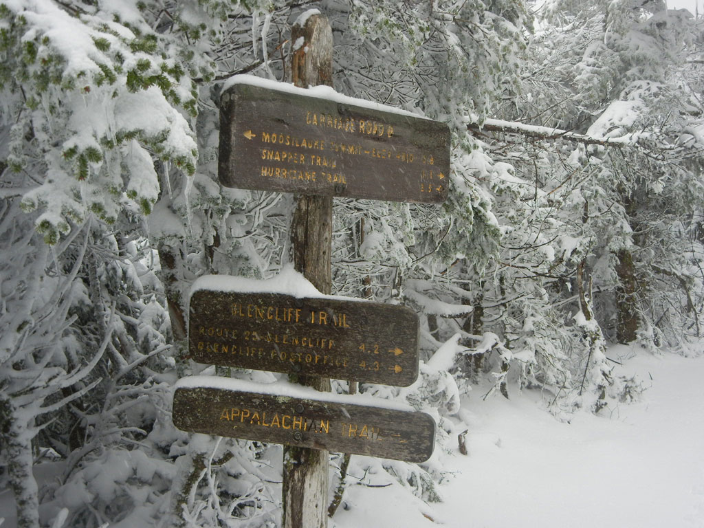
| 10:36 – Starting point to mount Moosilauke. Snow is just an fairy tale ornament here | From Ravine Lodge take Asquam Ridge trail – continue on Beaver Brook to the summit and return using Carriage and Snapper trails [click to enlarge] |
After many hours of weekend rain, sun was trying to take an upper hand, and I even had a dark glasses on. I started on the most obvious road to the top – the straight road ahead. I did not consult with a map because I thought that the straight route is the shortest road to the top.
 |
 |
| 10:41 Hiker should know his trail. Always consult the map. I did not. | 10:42 – Straight road is not the shortest way to the top |
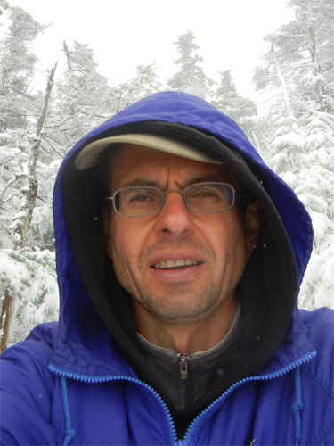
Previously, something happened with my camera and self-timer feature would no longer work. So I could only take pictures of myself only from an arms-length.
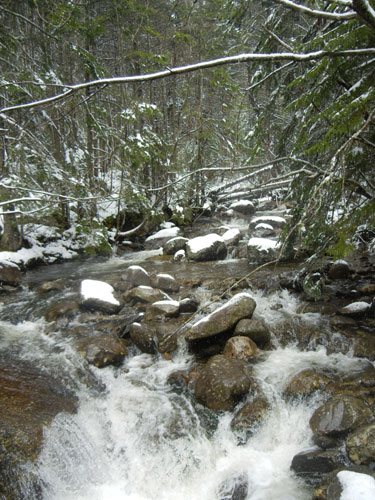
Few hundred yards into the journey I had to put my rain poncho back on. Snow and drizzle from melting snow from the trees just creates a steady flow on water on shoulders and feet. In about an hour I’ve reached a solid bridge across the rive covered in snow. Trail made a sharp turn left at this point, but I did not check with the map at this point, because of all the wet and snow.
 |
 |
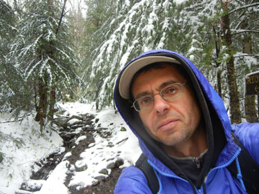
| 11:35 – One hour into the trip. Bridge is sturdy, but only few tracks are visible on the snow | 11:38 – It is wet, it miserable, it is fantastic |
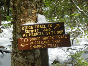
Another half an hour and at 12 noon I reached a split with Al Merrill loop, Everything was clearly marked, and even checked with the map, but my (imaginary) trail did not have any splits on the map. Instead of thinking of more logical explanations, I immediately assumed almost impossible – that they made another trail in the last several years, and that is why this point is not on the map.
 |
 |
| 11:59 – I did not expect to see another trail here. I found a “reasonable” expiation instead of thinking and checking the map | 12:00 Asquam Ridge Trail, but I thin I am on Gorge Brook trail. This trail featuring snow, puddles and assortment of stones. |
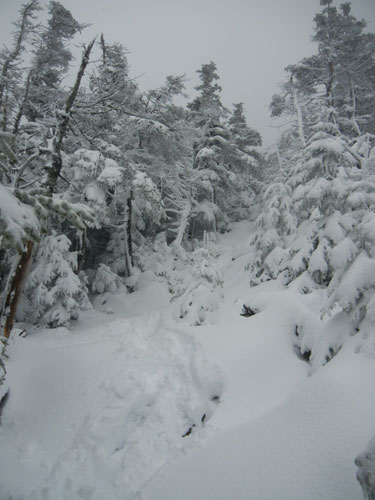
After the split the path went up and up, and all I saw was water and snow, and stones. Here I’ve met two cheerful groups. Both were returning without reaching the summit. First group of 2 parents carrying 2 kids in backpack and a dog. I called them – family of 5. Second pair was two teenagers – a Russian boy with a black girlfriend.
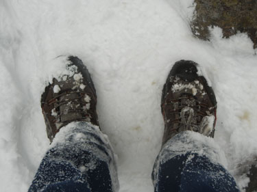
The climb was endless and gray. Then suddenly a descend began without any visible reason or marker. I’ve started to worry about my feet. At this moment the path was simply a deep snow several inches deep, with only few pairs of boots disturbed the surface of the fresh white. Before leaving I put on 2 pairs of socks – one thin performance socks and another pair – thick Timberland sock for boots. But instead of boots I had Merrell Cross Training Shoes. And everything at this point was thoroughly wet.
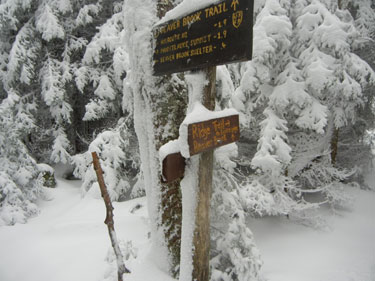
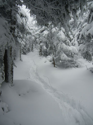
I already thought that it is time for the summit to be within reach, but I couldn’t make any visual identifications through endless trees covered in ever deepening snow. Finally at 13:27 I reached anther split in the trail – Beaver Brook Trail, and now I clearly understood that I took “wrong” much longer route and there is still 1.9 miles to go to the summit, and that I already took this section once back on Labor day weekend in 2011.
 |
 |
| 13:27 – I took me endless hour-and-a-half to cover 2 miles, and now (3 hours later) I knew I took the wrong trail | 13:28 – My feet are wet, road ahead is endless, and snow is quickly covering everything in sight |
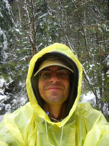
The decision I needed to make was either to turn back once again through the snow and puddles and slippery stones and with failure on my mind, or continue on all the way to the Summit and back through the originally planned trail. In a situation like this, it is impossible to stop for a while to think. Snow is everywhere and keep coming down strong. Everything is wet. There is nothing dry to sit on or even lean on. Even simply to take camera out is an operation of its own. One need to slide off wet gloves, and manipulate camera controls with freezing fingers. The only object worth shooting are trail sign, because that are excellent to document one’s progress later, like I am doing right now.
I’ve decided to keep going forward to the summit. The places I was walking now were all familiar. Show is deep. Feet are cold. Wearer is blizzard. Moving forward is hard, and one could barely see where to land the foot. One more single hiker going down with extremely long home-made walking stick. He is saying that conditions on top are awful. There is a deep snow, hurricane wind and absolutely no way to know where to go next. He is recommending for me to turn back. OK. I will think about it.
 |
 |
| 14:26 – Last mile to the top. Conditions will deteriorate, but confidence will serge. Where is poncho? – I am sitting on it on the snow. | 14:28 – Four hours into the trip. I found a way to dry up and warm up my feet. Now everything seems a bit cheerer than gray snow in the end of May |
Instead of turning back, I continued to climb. But now I am starting to worry. What if my feet to freeze? what to do? Who can I call help here miles away from roads and cell signal? Let me do the thinking.
I pick a quite spot between two trees. I am taking vinyl rain poncho off and you would see me sitting on it on the snow. I take everything off my feet and start vigorously rub by feet to bring more blood to the thumbs. In my backpack I do have a spare pair of dry wool socks, and to keep them dry longer I also put one 2 plastic bags on each foot. And my feet are very quickly getting warm now. Wow. One problem solved. Next is food – nuts and OJ. The strength is returning with a tasty treat. Time to gather my things and move on.
One more hiker is coming down now. This one is saying not to worry. It is tough, but I will be able to cress the summit to the other side and find my way through. It is 14:28 now, and I am hiking for 4 hours now. Now I met the last human group for today – 4 people coming down. They also talk about very strong wind, but other that that it is OK. But as far they are concerned, they turned back, because they could not see where to go next.
 |
 |
| 15:06 – Only few pairs of feet disturbed the surface of fresh snow. And no one walked on Benton trail today. | 15:07 – Last 0.4 miles to the top |
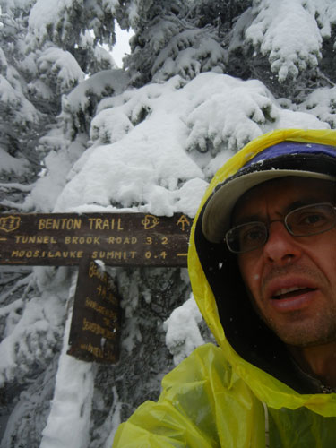
My next significant semi-stop and last before the summit was a split to Benton Trail at 15:06. Now I am just 0.4 miles from the Summit. Nothing is melting now. Snow only keep piling up. The Benton trail itself is completely covered in snow, there are now tracks on it. No one used this trail all day today!
Now I started to climb the last leg to the top. Here the climb is not very steep, but almost immediately you jump out of the woods onto an almost barren plane. There are not pictures from 15:07 to 15:48, but that was the time of ascend, and time of crossing the most unpleasant point on the trail – the Summit. Wind was trying to blow my poncho away and succeeded in blowing it off my head. The trail itself is completely covered in snow, and any traces or footprints are instantly covered by snow drift. I could not only take my camera out, but not even look at the watch. I it is all about selecting where to step next, and where is the next stone cone marker. It is more convenient to step on the edge of the trail, where sparse vegetation creates better grip, and snow is the most shallow. Any hollows on the surface is filled to the absolute top, so surface appears very even. Top of this particular mountain is very flat – many football fields flat. Even in a good weather there are no sharp stunning views. In all directions there are only stone fields and mosses.
This time everything standing was covered in icicles pointing in the directions of wind. So stone cone markers made about human height in the deem view look like spruce trees covered in snow. But there are now trees here on the top. The only possible place different from other places on flat plane are some crosses marking something, but they are completely covered in ice. According to the map the height here is 4,802′ or 1,464 meters. Snow id really deep only in hollows, but moving forward is relatively unobstructed. Ice in the ground is very porous, punctured by wind and snow.
 |
 |
| 15:50 – Dry wool socks with two plastic bags kept warmth and comfort for the rest of the trip | 16:12 – Summit is now 0.9 mile behind. It is all downhill from now |
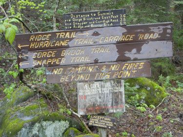
Next photo I took already on other side of the summit at 15:48. My feet are still warm and comfortable, despite shoes and pants being covered by snow. At this point I am already under cover of the trees again, and wind is no longer a factor. At 16:12 I took some pictures on first intersection after the summit, where Appalachian Trail veers off to the right through the Glencliff Trail. A one tenth of a mile appendix to South Peak was untouched by human feet. This intersection confirmed once more that I picked a Carriage Road Trail in the blizzard on top, and now I need to proceed 1.2 miles to pick a Snapper trail.
But my way forward will be all downhill from now. Within hours I will be back to the base, and everything will be perfect from now on. The snow continue to fall, by wind is gone and hade another little picnic to finish my food supplies in the backpack – water and trail mix and Vegan cookies from Trader Joe’s. I eat everything with great fervor, and everything tasted so delicious and perfect.
 |
 |
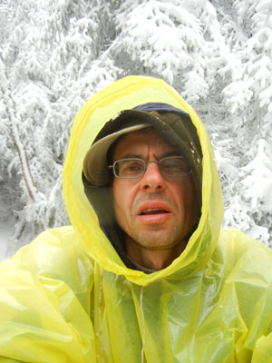
| 15:48 – First smiles after the Summit. It is cold, it is wet, but the hardest part is over | 16:56 – I can see some clearing in the sky. What could stop the hiker now? Only 1.7 to the finish. |
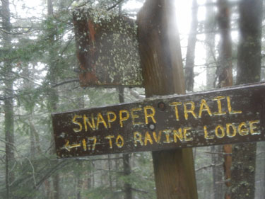
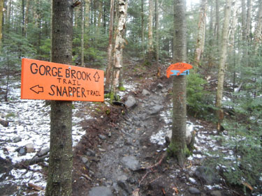
Carriage Road Trail is a wide and comfortable trail, and solid snow begin to give way to melting and puddles of water. Even sky begin to clear and wintry mix would accompany more and more patches of blue sky everywhere. IT seem to me that I am going on too long, and surely I missed the turn on my trail, but finally at 16:56 I spotted a sing to Snapper Trail. Another 1.1 and will be Gorge Brook Trail, that I was planning to take all along. It was now only 1.7 to the Ravine Lodge – nothing comparing to what I already walked today.
 |
 |
| 17:28 – Last leg of the trip. Snow is melting quickly here and rain is almost gone | 17:54 – The journey is coming to an end. There is no snow here and diner is only $14 at Ravine Lodge |
More merges and intersections followed. They moved a portion of Gorge Brook trail due to water damage, and I also so Hurricane Trail leaving off along up the Baker river. Finally at 6PM I emerged from the woods and took a one night residence at Ravine Lodge. Here is $35 you get a back bed with no heat in the hut, for $14 a dinner and for $8 a breakfast. This is a perfect spiritual place, where all patrons are hikers or almost hikers, and people are trading “war” stories and eat at the tables of 6.
Fireplaces (the only source of heat) are blazing on the main lobby and downstairs – in the library. There are also hot showers in main building. They take all kinds of credit cards and tips are greatly appreciated.

Be the first to comment