July 3, Wednesday
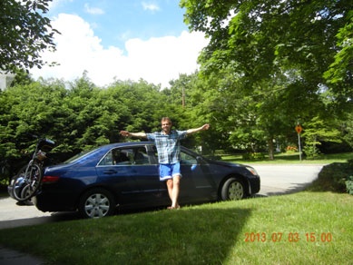
Around 13:30 on Wednesday things seemed slow enough at work that I saw an opportunity to make an early start for the White Mountains. I quickly gathered all the things, and departed by 15:00.
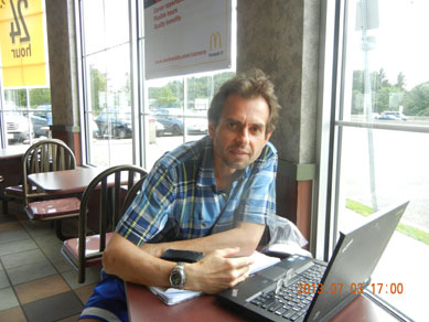
Around 15:20 a phone call caught me on route 128, and I made a stop on a Rest Area to connect to work and do some fixes. The connection was unusually slow, and I couldn’t get close to the windows (for better signal) because of the sun. Around 16:46 I was done, traffic became a solid menace by this time. Instead of braving the traffic for several hours on the way to New Hampshire, I decided to turn back home (only 11 miles), and try again tomorrow morning.
 |
 |
| 15:00 -I hope it is not to late to start to beat weekend the traffic? | 17:00 – Still working away at local McDonald’s on 128. Traffic is tough – I have to turn back home |
Despite hot weather we had a greats soccer game that evening, and plenty of people showed up. We lost though. And afterwards, I still had energy to go out and had a great time.
July 4, Thursday
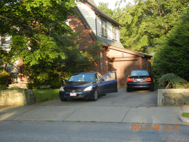
Next day – July 4, Thursday I woke up at 6:17 and left the house at 6:30AM. Everything worked out perfectly. The weather. The calendar. The schedule. This time I took 93 instead of route 3. It looked a bit straighter on the map. Plus, only one road toll this way.
My usual ritual begins with Price Chopper (08:47) in Lincoln, NH. They are open 24 hours, and I got OJ, apples, oranges, 3 bananas for 3 mornings and 6 fresh croissants – my weakness. Some dry fruits and nuts mix I brought with my from home.
 |
 |
| 06:24 Let’s hope second start will be more succesful | |
 |
|
| 12:35 First half of the day for logistics – next is | 10:52 Tomorrow I will start from this point up |
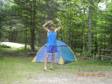
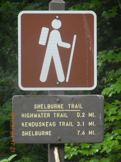
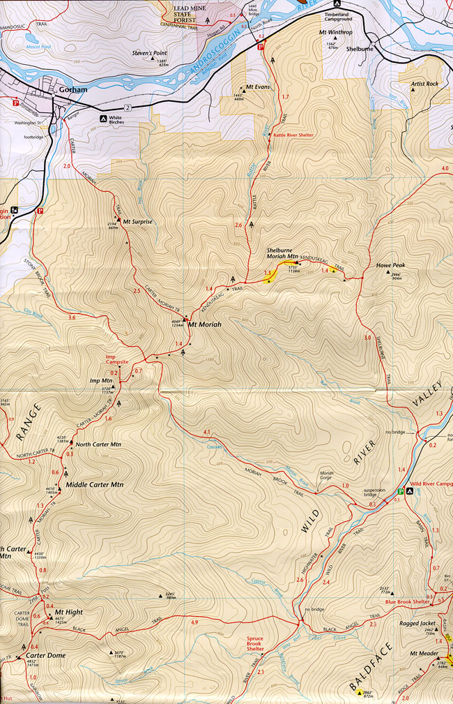
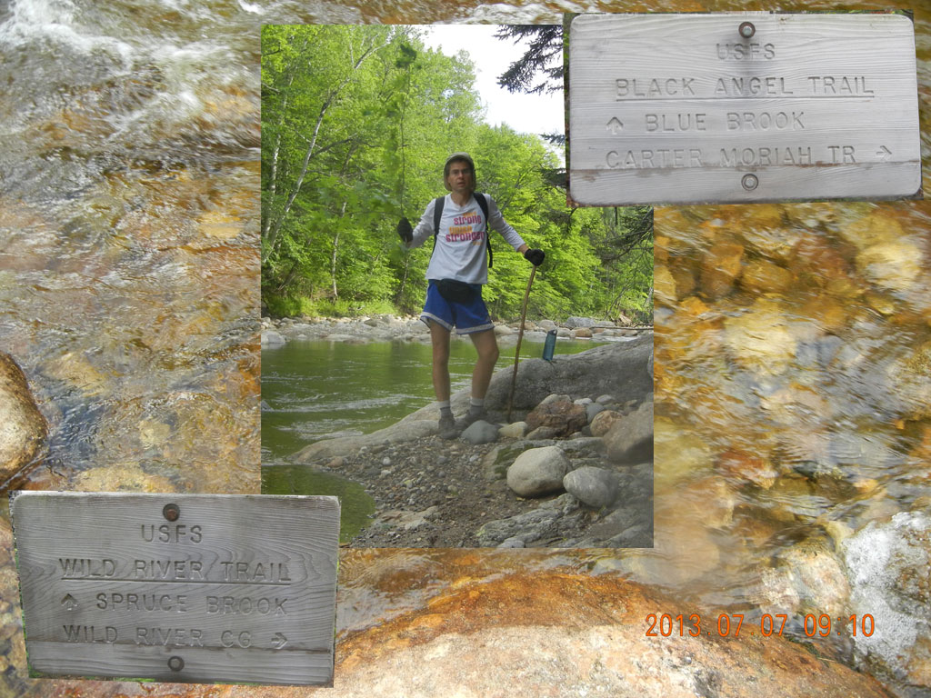
Fist meal stop – in Lincoln Bagel place – herbal tea and bagel with lox. Around 10:50 I found an exact spot where I would start tomorrow. At 11:30 I arrived to Wild River campground and paid $32 for 2 nights. There where 3 available spots to cheese from . I picked site 5.
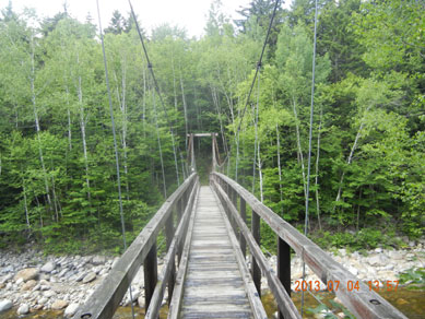
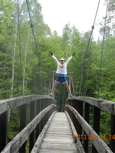
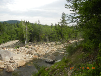
I setup a tent and at 12:55 I started out to explore trails around the area. First I saw a suspension bridge (13:57) and crossed the river. On the other side I found the trailhead (14:14), where I will be returning from my trip tomorrow evening. I ford the river to the campground side and found the Wild River trail. I returned to the suspension bridge, crossed the river one more time, and this time continued down stream on High Water trail. Here the river just recently expanded, and the trail is heavily damaged and non-existent in places.
 |
 |
| 13:57 Some sources state that this bridge was destroyed by Irene on August 28, 2011. But who would build it back? | 15:12 moving away from the bridge on High Water trail |
At one point I lost the trail and started to work upstream on of the tributaries. While trying to cross the smaller river, I’ve got my feet wet, a large drops lazy rain started to fall, and all the bugs get closer to the ground, and become really annoying. And I still could not find the proper trail.
Instead of worrying, I just dropped all my close and took a perfect dip in the spring. Body cools off, and bugs having harder time to navigate by the infra red worth. Wide sweep in the woods, and finally at 17:10 I found Kenduskeag (“pleasant walk”) trailhead. Despite meager 0.2 miles to the trail on other side of the river, it was a difficult trout. Trail is not visible, many small springs go in various directions, and the river here is calm, but deep – up to 3-4 feet in the water.
 |
 |
| 14:02 – camera self-timer (10 seconds) is barely enough to run half the bridge and climb the railing |
17:27 – On the way back to campground. First day is drawing to a close |
at 17:26 I was in the road and another mile up, and I returned to the campground. A large droplets were covering the tent. I spread a huge 14′ by 14′ tarp high above the tent to prevent any further elements from wetting the tent. I have a very potent technique how to attach a large spread of the tarp to the trees using one long rope and a stone.
What did I have to eat? I knew that it will be my last chance for cooked food till Saturday afternoon, so I drove 20 miles one way back to Gorham and ordered salad and vegetarian tacos. Town center was engulfed in holiday festivities and carousels fun despite some rain.
Back at the campground it was getting dark around 9PM. One last refreshing swim in the river, and I am ready to sleep.
July 5, Friday
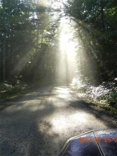
After uncomfortable night (too hot, too cold, too hard, too narrow), and I woke up at 6:25. Very quick start, and I am driving to my destination at 06:51. The trick here was to think next 24 hours through. I need cooking and foot in the tent. I need dry shoes for tomorrows bike ride. I need to leave the bike itself and attach all the needed accessories (like saddle and spare tube) to it.
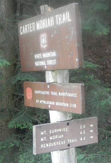
My walk on Carter Moriah Trail started at 08:06 off Bangor street in Gorham. I’ve noted that tomorrow I would need to ride my bike for a bit over 20 miles to return to my car. Around 9AM I’ve realized that I did not packed the water with me – only a small bottle of orange juice.
 |
 |
| Friday track – from Gorham to Wild River campground – 11.2 miles | 07:11 July has plenty of gorgeous day light hours |
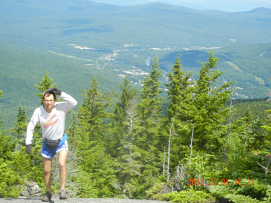
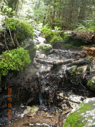
Not to worry. I finished the OJ and started to look for sources of fresh water. All small puddle of water I’ve tried had an earth taste. Only around 12:29 I found a running spring right in the middle of the trail, and water here was fresh and clean and cold. Perfect. The confidence and strength returned, and in a few more minutes (12:41) I’ve reached the mount Mariah (4049′ or 1234 m). At this point I advanced 4.5 miles, and 4.5 hours on the trail. Here on the very top you have a 360 degrees view, but bugs are still here as well.
 |
 |
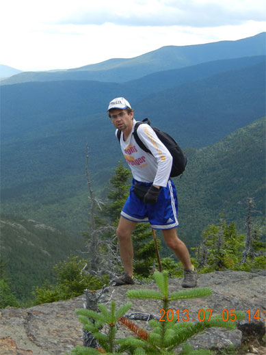
| 10:21 I turned around and noticed that I already climbed pretty high – view towards Gorham and Berlin | |
 |
|
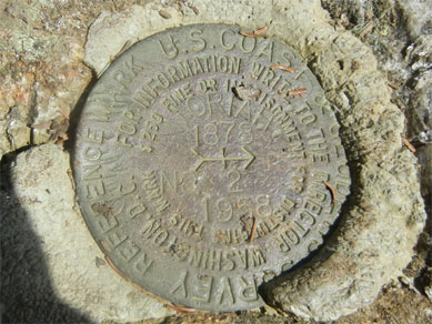
| 12:42 There are two Geological Survey markers at the top. The height here is 1234m or 4008 feet. | 12:29 Finally I found water that is transparent and tastes good |
I’ve spent an hour at the top, had my tan and my food (nuts, apple and orange) and some pictures. At 13:46 I continued the travel on Appalachian Trail (still Carter-Moriah trail) towards Imp shelter and Wild River trail. This is the most picturesque segment of the trail, where you often have unlimited views into both valleys.
The only uncomfortable thing is that direction of the trail is almost opposite to your previous gains, and one begins to doubt, if this a right trail after all. Not to worry. There are no other trails around.
 |
 |
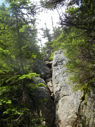
| 13:50 – This is a very short connector from Appalachian trail to Mt. Moriah. Last boy scout is visible on the top | 14:29 This section of Carter Moriah trail is almost all open with good views in both valleys |
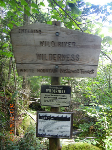
By 3 PM I’ve reached an intersection with Wild River Trail and entered Wild River Wilderness. Now I would have a 5 miles downhill all the way to Wild River and to my campground. That is a rarely used section of White Mountains. I only met one young couple at the very beginning of the trail, who were camping at Imp Shelter nearby. Other than that, it was a wet and fascinating walk. No way to know exactly, how far one advanced except for the hours elapsed from the start. But you get to see how several tiny springs slowly merge together to form a bigger and bigger stream. At first the spring is the trial. You just step on the stones, and water trickling down around the stones. Later you cross the springs all the time. Later yet, trail have to stick to one side of the river for some long miles, and finally crossing the Morian river requires removing you shoes, if you do not want to get wet.
 |
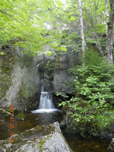 |
| 15:05 This is the newest wilderness in White Mountains. It was decreed to appear only in December 2006. | 15:43 Every pool of water offers a great swimming opportunity. Small springs turn into . . . |
Second half of the trail invites more bugs and bogs. For bugs the best way to fight them is to fan oneself with a maple branch. As for bogs as concerned, do not miss a fantastic dam that was build by beavers. They maintain the water level a good 3 feet above the normal ground level by blocking the water flow with trees and branches. Talk about changing environment to suit someone’s needs.
When you cross the river one last time – this place is marked on the map as Moriah Gorge, but there are nothing their. May be years ago it was a narrow water passage, but hurricanes and storm of the last few years washed away many obstacles, including probably this gorge.
 |
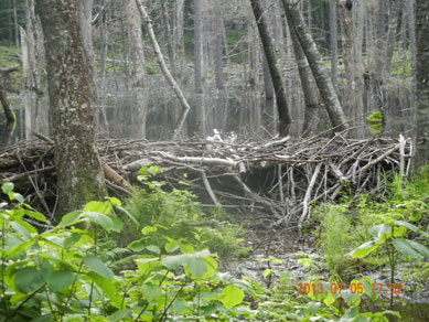 |
| 17:17 . . . turbulent rivers | 17:52 Do not miss a beaver country, where water is held back by their dam 3 feet high |
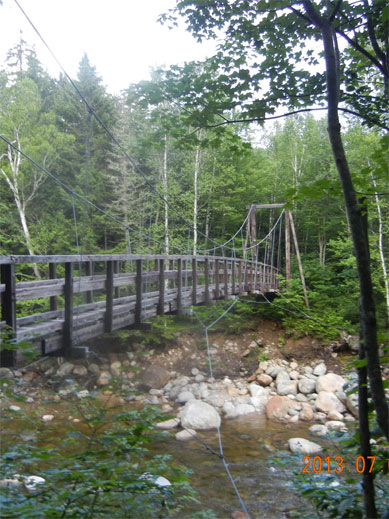
But this was a good sign for me. After 10 hours on the hike, I knew that only 1.6 miles left to the campground. Before finished line I took a thorough splash in the river, put on my fresh warm clothes that I was carrying with me, but didn’t need because of the warm weather on top the mount Moriah, and around 7 PM I walked into campground, and even was check by the hosts – do I actually belong to the site number 5, and where is my car.
What did I eat? I had fresh croissants and strawberry preserve that I bought many years ago. I had enough energy to pile a bunch of wet branches into the fireplace and boiled some water for my tea. Plus I still had apples, oranges and nuts.
 |
 |
| 19:12 Bridge was a welcoming sight – campground and rest are just a short distance away |
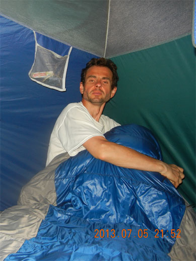
21:52 Days is over. Night would be warm, but one would still need a sleeping bag |
July 6, Saturday
Better sleep, later wake up. Around 7:17 this time. During long weekend all the time is yours, and there is no time to spare.
I had just over 20 miles ahead of me to return to the car on my bike. I paid another $16 for the stay here at campground and check how much water I packed this time – 2 Poland Springs bottles. Water and banana for breakfast, and I am on the road. First 10 miles all downhill along the Wild river.
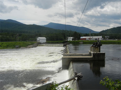
Riding on route 2 was a bit tougher. Warm sun and gradual gaining of elevation along Androscoggin river did the trick. I finally stopped at the abandon rest area / tourist information hut (right next to Timberland Campground) for a meal and some rest (10:34). Here I finally opened and ate 2 Lava Bars that have super-short ingredients list: peanuts, dates, sea salt. Amazing. That gave me enough energy not to go directly back to the car, but take a long detour – cross the river at Shelburne Dam (11:34) and continue on the other quiet and undeveloped side of river on Hogan Road.
 |
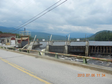 |
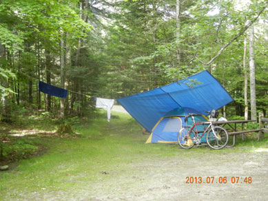
| 07:48 No car, just bike. And a beautiful day ahead to get to the car | 11:34 Unplanned deviation – Shelburne Dam – Appalachian Trail crosses here |
This is a very interesting place to ride for cyclists. Appalachian trail continues here. Dirt road goes for many miles along the river with many exist to the water and hidden forest roads leading to firing ranges. You encounter several more dams that are all part on hydroelectric system that is still operational. And it is very quite and isolated road. Perfect for weekend relaxation.
I was looking for a next bridge to cross back into Gorham, but all the dams were completely unsuitable for crossing. At some point I choose to go along the electric lines instead of a more visible road that was departing down toward the river. That is were I missed my opportunity to cross the river early. Instead, I continued on a disappearing road under electric lines, and eventually road disappeared completely, and found myself in the middle of thick underbrush with no visible path and a bike that become just a hindrance in this situation.
 |
 |
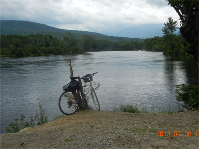
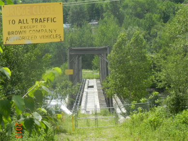
| 12:10 – Hogan Road, Gorham, NH – one of the best places to bike | 12:44 I am about to miss a bridge to other side. Bridge is a not a small thing to miss |
My iPhone map showed that somewhere near me there is railroad track going parallel to the river. I thought that rail tracks are better than brush and poison ivy, so I started inching through the forest brush, and suddenly nearly 30 yards from me 2 bikes or ATVs or some other powerful vehicles roared through right where my railroad should be. It was a little miracle. The rail road here was already converted into a straight and convenient dirt road, and now I realized that pretty soon I will reach Berlin with plenty of bridges to cross the river.
Only at 14:03 I finally reached a auto bridge in Berlin as Unity street. That was a mini-celebration. And it was an interesting adventure. Now a had long way to return, but it was all open roads from now on.
I was very impressed with Walmart (15:00). I found here everything I needed for my evening meal and even individual wrapped ice-cream. And very, very reasonable prices. That was a good break from the sun and heat. Greek Salad at Gorham House of Pizza was first prepared meal in 2 days (16:08). Pizza visitors were impressed with a tic that I removed from my leg.
 |
 |
| 13:52 I found this bridge, but I couldn’t use it. This is just at Berlin – Gorham border | 16:24 – Back to the car after 32 hours away |
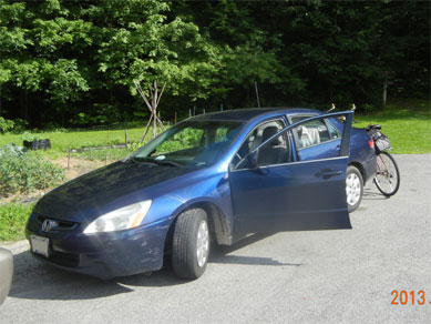
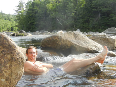
Just a little more pedaling and I returned to the car (16:24). It was hot and car was hot, but I was glad that the adventure is over. On the way back to campground I was stopping frequently along the Wild river to jump into the water. I stopped right on the Maine/New Hampshire border and decided to shave after almost 9 days without shaving (17:28). Water was great, and It was very quite despite the long weekend.
On the way back to the tent, I’ve loaded the space between bike and the trunk with dry firewood, and arrive to campground with branches sticking out every which way – quite a spectacle.
 |
 |
| 16:52 – Frequent stops to enjoy Maine / New Hampshire natural beauty. Hot mean just right in the mountains. | 19:16 Cooking is a bit overdone, but joy is overwhelming |
Finally, I had an quite evening ahead (18:27) to try to feed myself with roaster potatoes and mushrooms. Fire started easily this time, but I needed less file and less heat. Everything came out a bit burnt, but it was a memorable supper anyway. Perfect, long and interesting day in the woods. One last swim in the river, and one last picture in the tent at 21:06.
July 7, Sunday
First picture at 07:14. Quick gathering of thoughts and some food, I am on the road again at 07:43. The idea was to reach as far as possible into the wilderness up the Wild river to record my deepest penetration. Next time I probably will start from the other end and create an imaginary link.
 |
 |
 |
| 07:43 Last day – last trip into wilderness | Detail: from campground to the Black Angel trail | 09:06 Target reached – Black Angel trail |
I did take with me only water and some nuts – light and easy stroll. In 8:31 I stopped and found a sturdy water bottle under the trees branches. I thought that is a sign to re-group. Here on the water edge I dropped all the stuff and decided just to run the marker for Black Angel Trail. According to the map, the total distance from the camp should have been 2.7 miles. I started running pretty brisk from 9:00 to 9:06. Here it was. Everything was here. Some hikers were already changing their shoes after water scrossing. From 09:14 to 09:20 I ran back to my things. Now the plan was to reach the camp by 10AM.
Trail here sometime lays on the former log road, but sometimes it is completely washed away by the river, and one has to cling to the cliff on a newly created path. Expect mud and wet slippery conditions on such intervals. At 09:59 AM I did emerge from the woods, and folded all my things in record 40 minutes. It was only 10:49, but I already walked 5.5 miles and had all day ahead of me for slow and deliberate return home.
 |
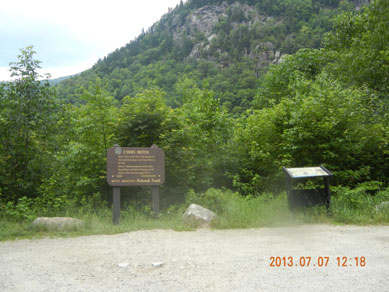 |
| 09:40 – Trail sometimes completely disappears – washed away by Irene in August 2011 | 12:18 – Evans Notch – Elevation 453 m (or 1,486′) according to my iPhone |
After several swim and eat stops on the river, I drove on quite route 113 to the high watershed point (unconfirmed elevation 432m or 1,417 ‘). It was 12:18. From this point it will be all down hill, and it really felt that trip is closing to an end. I’ve reached Maine town of Fryeburg at 13:30 and ate my Greek salad with feta on the side at the only square with the only traffic light in town.
 |
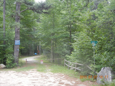 |
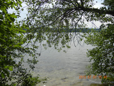
| 15:45 White Lake is amazingly shallow, but water is clear and discovery hides around every corner | 16:17 The very last picture of the journey – back entrance to White Lake park from (very appropriately) Chipmunk Lane |
At 15:33 I’ve reach the point, where traffic stopped my progress, and I immediately turned into a White Lake Park off route 16 in Tamworth, NH. Here I parked on a main free parking lot and found a bike path starting behind the Showers/Toilet booth. Bike eagerly rolled down, and I emerged out of the woods in zone 3 and sites with water view. Lake is extremely shallow here, and even 100 meters from the shore you still can stand in the water. But for camping this is a very good spot.
 |
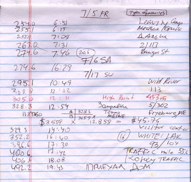 |
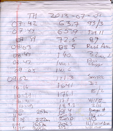
| First page of mileage log: July 4 Thursday | Second page of mileage log: July 5 Fri – 7 Sun |
One of the paths starts behind camp site 2-53 (or 2-58 ?) and links to a corner of South Way and Chipmunk Lane. From here you can ride to route 16, and check if traffic cleared – it did (16:27).
At 17:30 I jumper on 93 at exit 23 (route 104), and with 20 minutes traffic delay reached home at 19:43. The entire 4 days and 3 nights trip took 492.2 miles.

Be the first to comment